
Delivery snapshot
Record date: January 13, 2026. Technology and screenshots describe the delivered version documented on this date. Any performance observations belong to the same point-in-time record. The linked live site may include later changes made by the client or other providers.Business context
RampTracker is an independent product I created and shipped, not a client commission. I own the product decisions, implementation, release process, and ongoing maintenance across iOS and Android.
I also built RampTracker Web, the browser companion for exploring and sharing boat ramps without installing the app. Both are personal projects that I continue to develop and maintain.
Problem
Boaters need location-specific information before choosing a launch point. RampTracker organizes a large catalog of boat ramps across the United States and Canada so a person can inspect a location, review details, and keep useful places available from a mobile device.
Constraints
The core workflow needs to work on mobile devices in locations where connectivity may be limited. Map exploration, satellite imagery, detailed ramp data, community reports, favorites, and history must remain understandable within a compact interface on both supported platforms.
Decision
The product was designed around map-first discovery, location detail, and community-maintained information. The interface prioritizes a quick transition from map exploration to a ramp record, with offline-aware mobile behavior for use away from reliable connectivity.
Delivered experience
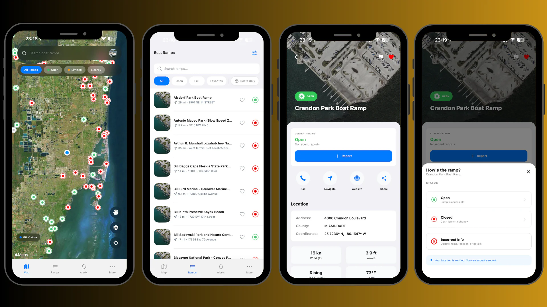
RampTracker is a mobile application with interactive maps, satellite imagery, ramp records, community reports, favorites, history, and offline support. The data model supports detailed ramp attributes and user-facing status information without requiring a separate desktop workflow.
Map and ramp discovery
The map presents ramp locations with high-resolution satellite context. A selected ramp opens a detailed record with launch information, location data, and the surrounding map context.
Community and personal tools
Users can submit real-time community reports and save favorite ramps. History and offline data support repeated use when a person is traveling between launch locations or has limited connectivity.
Navigation and feedback
Interactive map controls, detail views, loading states, and mobile navigation keep the core flow focused on finding and evaluating a ramp.
Ownership and support
I own the product direction, mobile and backend implementation, data-source integration, iOS and Android release process, and ongoing maintenance. That responsibility includes evaluating product changes, preparing platform releases, and supporting the live application across both stores.
Technology
The mobile stack uses React Native with native platform tooling. Maps combine a map SDK with satellite tiles and location data. Backend services support ramp records, community reports, favorites, history, and synchronization, while the interface is structured for iOS and Android device use.